UP and Bihar Weather Forecast – What’s Happening Right Now?
Rainy days are back and the monsoon is still pushing hard across northern India. If you live in Uttar Pradesh or Bihar, the latest IMD alerts mean you should be ready for heavy showers, possible flooding, and sudden thunderstorms. Below we break down the current situation, tell you where the rain is strongest, and give you simple steps to keep safe and dry.
Current Alerts in Uttar Pradesh
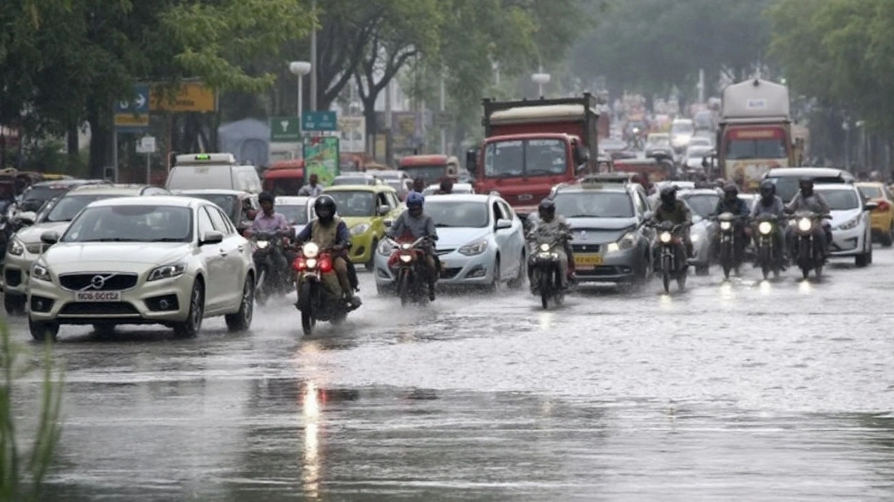
Right now, 15 districts in western and central UP are under an orange alert, while Lucknow sits on a yellow warning. The orange zones are seeing rain totals well above normal – Lucknow logged more than 300 mm last month, that’s over 50 % higher than usual. Forecasts say the rain will stay moderate to heavy through early September, driven by a western disturbance mixed with cyclonic circulation.
What does that mean for you? If you’re in an orange‑alert district, expect at least 30‑50 mm of rain each day, with occasional bursts of 70‑80 mm. Streets can flood fast, especially in low‑lying areas, so avoid traveling if you can. If you must go out, keep a waterproof bag for electronics and wear sturdy shoes to prevent slipping.
For those in the yellow‑alert area like Lucknow, the rain isn’t as intense but still enough to make traffic crawl. Carry an umbrella and a light raincoat – the showers are usually brief but can be heavy enough to soak you if you’re caught without protection.
Bihar Rain Watch
Bihar is also feeling the monsoon’s punch. While there isn’t an official orange alert for the whole state yet, several districts have reported lightning activity and localized heavy rain. A recent buzz about a lightning warning for seven districts on August 21 turned out to be unofficial, but the IMD still expects scattered thunderstorms across the state throughout August.
Typical temperatures sit between 28 °C and 35 °C, so heat combined with humidity can make the heat index feel like 45 °C in places like Delhi. In Bihar, the humidity keeps the atmosphere sticky, and sudden downpours can turn dry roads into slippery hazards within minutes.
Practical tip: keep an emergency kit in your car – a flashlight, a small first‑aid pack, and a blanket. If you’re planning a trip, check the IMD’s short‑term outlook before you leave. Most apps now push alerts directly to your phone, so enable notifications for the “rain” category.
For both states, the best way to stay ahead is to monitor the IMIM’s hourly updates. They give real‑time rainfall intensity, wind speed, and any flood warnings. When the forecast shows a high chance of thunderstorm, try to finish outdoor chores early in the day and avoid standing under trees during lightning.
Remember, heavy rain can cause power cuts, so keep some backup chargers and a few batteries handy. If your area is prone to waterlogging, elevate important documents and electronics on a shelf or table. A quick check of your local drainage after a downpour can also help you spot problem spots before they become a bigger issue.
In short, UP and Bihar are in the thick of the monsoon, and the rain isn’t letting up anytime soon. Keep an eye on the alerts, plan your travel around the forecast, and make sure you have the right gear. Stay safe, stay dry, and let the monsoon pass without ruining your day.
 4 September 2025
Delhi-NCR Rain Alert: IMD warns of heavy showers on September 1 as temperatures dip
IMD has warned of rain and thundershowers across Delhi-NCR on September 1, with light to moderate spells likely in the afternoon and evening. Temperatures have dropped, with highs near 28–30°C and lows at 22–25°C, both below normal. Similar rain is expected in parts of UP and Bihar. Authorities have advised precautions in urban and hilly areas under orange and red alerts.