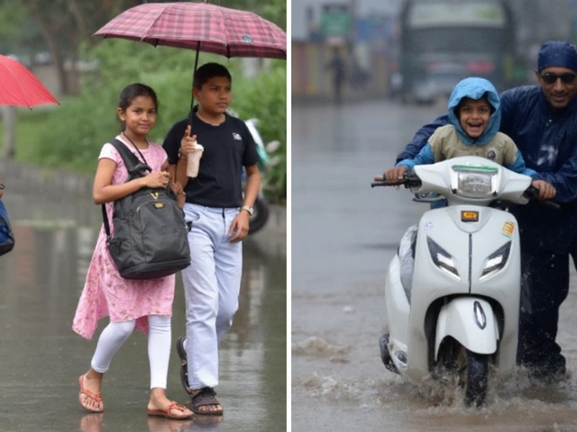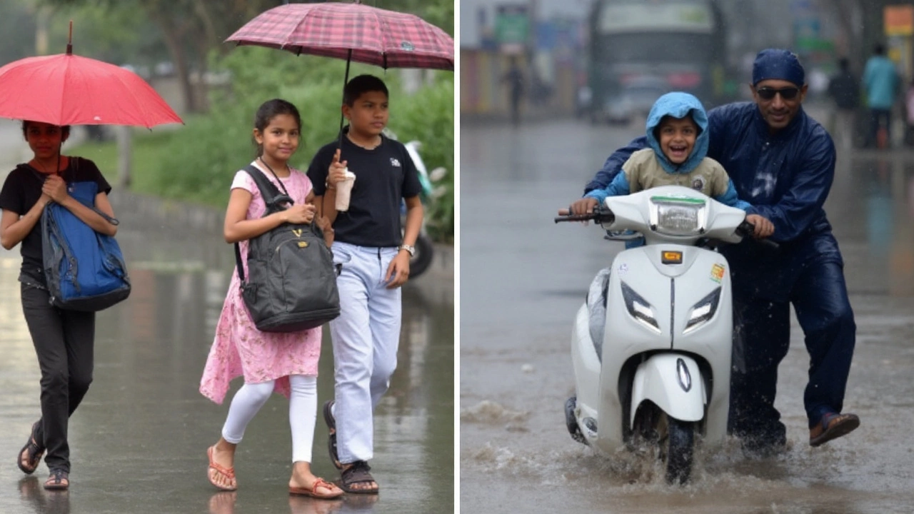
An 87% chance of rain lines up with the afternoon rush in Delhi-NCR today, and the weather office has a clear message: expect on-and-off showers, keep rain gear handy, and leave extra time for travel.
Delhi-NCR: What to expect through the day
Clouds will hang around most of Saturday, with intermittent showers and a few thunderstorms. Temperatures will swing between 26.8°C in the early hours and about 33.9°C at the day’s peak. Humidity will stay high, rising into the 79–96% band during and after showers, so it will feel warmer than the thermometer shows.
The best chance for rain is in the afternoon, especially from 2 PM to 6 PM. Winds will be easterly and gentle, mostly 10–20 km/h, with brief gusts around 15 km/h near showers. Pressure will hover in the 733–736 mm Hg range. Skies will be partly cloudy in the morning, turning mostly cloudy by midday as towering clouds build along the Aravallis and the Yamuna floodplain.
Here’s a quick timeline for planning:
- Morning (7–11 AM): Warm and sticky near 27–30°C. Patchy clouds, a stray light shower in a few pockets.
- Midday (11 AM–2 PM): Partly to mostly cloudy. Temperature near 33–34°C. Feels muggy.
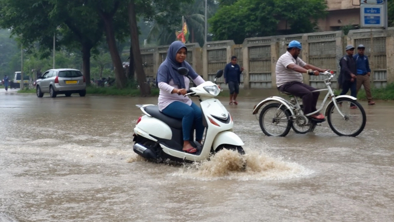
- Afternoon peak (2–6 PM): Highest rain probability. Short, sharp spells could bring waterlogging and slow traffic.
- Evening (6–10 PM): Temperature slides toward 28°C. Drizzle or a light shower may linger with high humidity.
Commuters should watch for slowdowns on key corridors that flood easily—think ITO, Minto Bridge underpass, parts of Gurugram’s MG Road and Golf Course Road, and some low-lying stretches in Noida and Ghaziabad. Metro services usually hold up well in rain, but do expect heavier crowds during downpours. If you’re headed to the airport, add buffer time for taxi delays and lower visibility around squalls.
What to wear and carry? Light, breathable clothing works best in this humidity. Pack an umbrella or a light raincoat for the afternoon. Waterproof footwear helps if you’ll be on foot around market areas. If you have asthma or allergies, keep medication handy; damp, stagnant air after showers can feel heavy.
Sunrise is around 6 AM with sunset near 6:45 PM, so there’s plenty of daylight, but the cloud deck will dim the sun on and off. Outdoor workouts and kids’ activities fit better in the morning window before the heavier showers arrive.
For quick reference, today’s headline in one line: Delhi-NCR rain alert with intermittent showers, peak rain chances in the afternoon, warm and humid all day.
UP, MP and Bihar: Heavy rain risk and local impacts
The rain belt is not stopping at Delhi. Weather models and satellite pictures point to a moist easterly flow feeding into the monsoon trough, firing up heavier showers in parts of Uttar Pradesh, Madhya Pradesh and Bihar through the day and into the night.
Eastern and central Uttar Pradesh could see the most persistent spells, with downpours at times across districts around Varanasi, Gorakhpur, Prayagraj and nearby belts. In Madhya Pradesh, watch the northeast and east—Jabalpur, Rewa, Satna, and adjoining areas—where cloud tops are colder and storms can stack up. Bihar’s north and east—Purnia belt toward Bhagalpur—as well as Patna and Gaya can also catch heavy rain in bursts.
What does “heavy” mean in plain terms? Rain strong enough to cut visibility, pond water on roads quickly, and push drains to the limit. Localized flooding is possible in low-lying neighborhoods, underpasses, and along smaller streams. Lightning and brief gusty winds may accompany the strongest cells. Rivers are already running high in some stretches, so fresh inflows from upstream could stress embankments—stay alert to local advisories if you live near a river.
Travel and daily life tips for the three states:
- Roads: Avoid waterlogged lanes and underpasses. Do not drive through fast-moving water; take detours.
- Rail and air: Short delays are possible when intense cells pass. Check live updates before heading out.
- Power: A few local outages can occur where lines and branches interact. Keep devices charged.
- Farmers: Secure fertilizer and seed stock from damp. Drain excess water from fields if possible; paddy fields can handle standing water, but vegetable plots and pulses need quick runoff.
- Health: Boil or filter drinking water in flood-prone areas. Keep a basic kit—ORS, antiseptic, dry snacks—ready.
Why the uptick now? A slow-moving monsoon trough near the plains, paired with steady moisture feed from the Bay, is stacking up cloud clusters and thunderstorms over the Indo-Gangetic belt. These setups can wobble by a district or two, which is why one town can see a torrent while another 30 km away gets light rain. Expect the heaviest bursts late afternoon to late evening, tapering to lighter rain overnight in many spots.
If you have weekend plans—religious gatherings, markets, sports, or travel—keep a plan B. Morning slots offer better odds of dry weather. For organizers of outdoor events, tents and raised stages help avoid last-minute scrambles when the first heavy cell rolls in.
Bottom line for the region: Delhi-NCR will juggle sticky heat and afternoon showers, while parts of UP, MP, and Bihar face heavier spells with short-term flooding risks. Keep alerts on, keep gear handy, and give yourself time to move safely.