Orange alert through July 31: what's driving the monsoon surge and what to expect
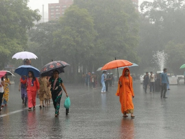
Heavy showers returned to the capital and the warning level isn’t easing yet. The India Meteorological Department (IMD) has issued multiple orange alerts for Delhi and the wider National Capital Region through July, with the most intense phase hitting July 22–23 and more wet spells likely to roll on till July 31. An orange alert means “be prepared” for disruptive weather—short bursts of intense rain, frequent thunder, and the kind of waterlogging that can stall traffic and strand commuters.
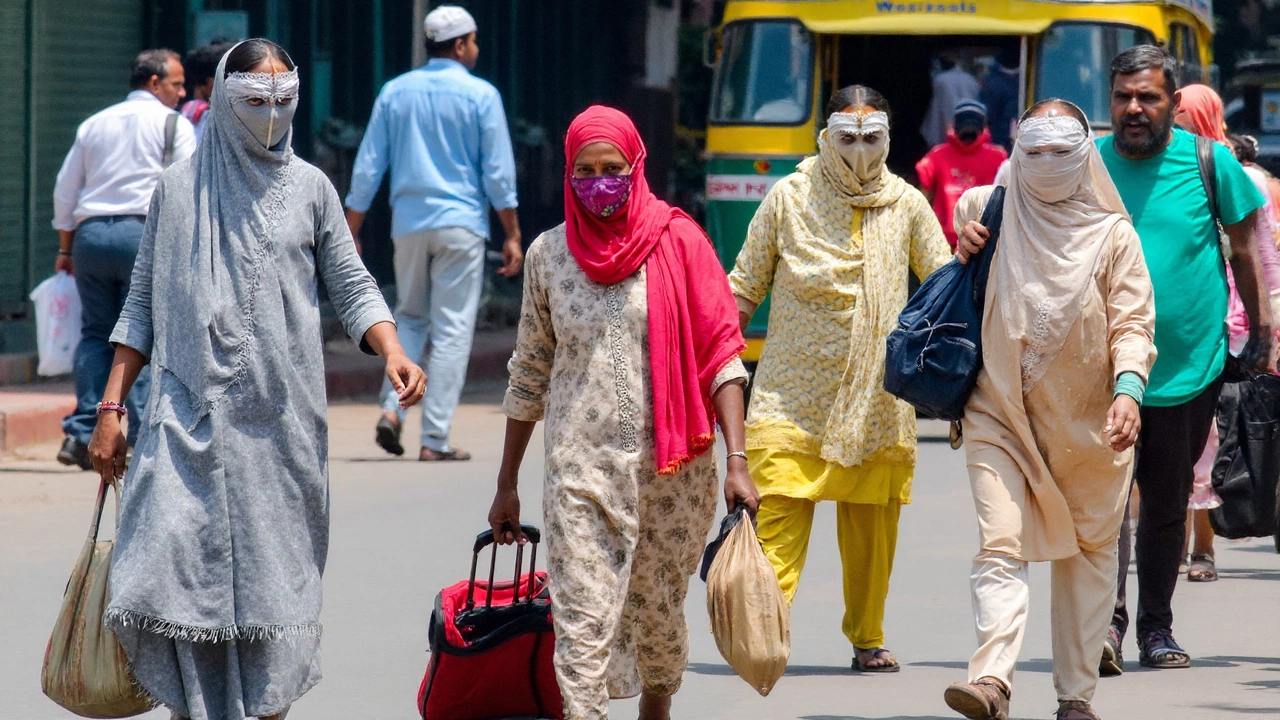
Across the month, the IMD activated the alert several times as systems lined up over North India. On July 22, the bulletin covered a wide swath—Jammu and Kashmir, Uttarakhand, Maharashtra, Goa, and Telangana—while keeping Delhi under watch for cloudy skies with light to moderate showers. A day later, the sky opened up over central and southern parts of the city, and the downpour spread across core corridors of New Delhi and South Delhi. Minimum temperatures hovered in the mid-20s and daytime highs slid to the low 30s, a clear drop from the heat that dominated earlier in the month.
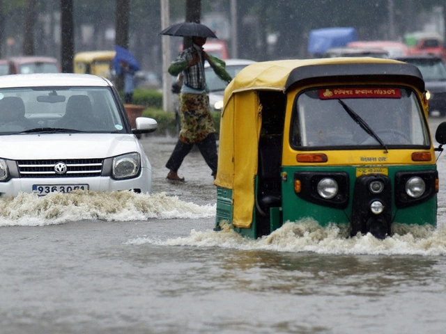
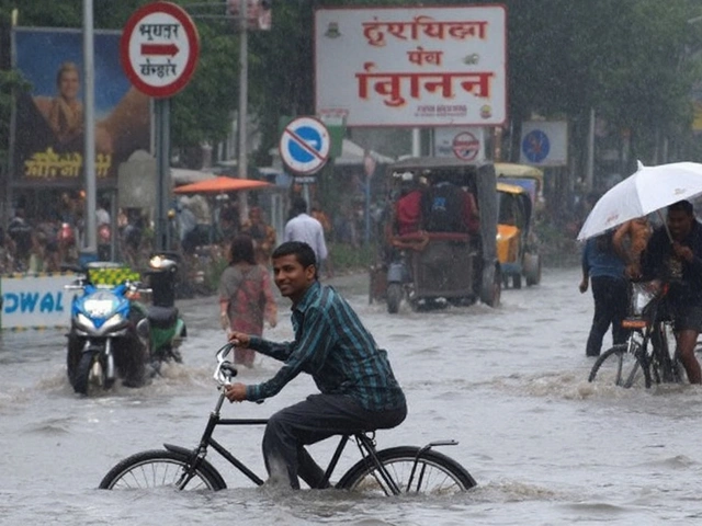
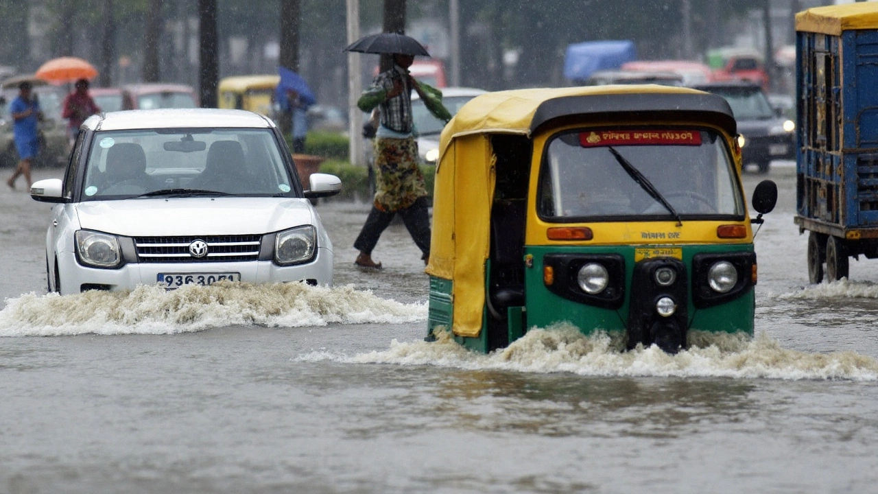
The most visible fallout came on the roads. Persistent rain on July 23 flooded stretches under the Mahamaya flyover and near Ambedkar Park. Around India Gate, Mandi House, Tughlak Road, and the approach roads to Indira Gandhi International Airport, standing water slowed traffic to a crawl. Drivers kept headlights on through the day as visibility dipped in heavy bands of rain. Similar scenes played out in Noida, Ghaziabad, and Gurugram, where low-lying pockets and underpasses turned into chokepoints.
IMD’s short-term guidance points to a stop-start pattern: light to moderate rain interspersed with heavier bursts and thunderstorms, especially in the afternoon and evening. For Delhi, the temperature band is expected to stay roughly between 23°C at night to 36°C during the day, with cloud cover limiting daytime heating. When the heavier cells pass over, the mercury falls quickly, but humidity stays high, keeping the air feeling muggy between spells.
Why the uptick? The monsoon trough—the season’s main rain-bearing conveyor belt—has shifted north and now sits closer to the Indo-Gangetic plains. That position pulls deep moisture from the Arabian Sea into North India. On top of that, a fresh Western Disturbance is sliding in from the northwest. When these two systems interact, the atmosphere primes for short, intense bursts of rain and lightning, even if the total rainfall doesn’t look extreme on paper. That dynamic is why local flooding keeps showing up even with gaps between showers.
The alert isn’t just about Delhi. North India is in a broad wet phase, with IMD flagging heavy rain spells over the Himalayan belt and central-western states. Down south, the department has warned of isolated heavy rain over Kerala, Mahe, Karnataka, and Tamil Nadu from July 23 to 28, and over Coastal Andhra Pradesh, Yanam, and Telangana from July 23 to 26. Moisture feed on both coasts is active, and localized thunderstorms there can turn sharp quickly.
There’s a silver lining: the rain has washed the air clean. Delhi’s Air Quality Index has stayed in the “satisfactory” band for eleven straight days—one of the longest steady stretches this year. Wet deposition knocks particulate matter out of the air and stronger winds help disperse what’s left. Expect the AQI to stay decent while showers continue. If there’s a long dry break, pollution can creep back.
What does an orange alert actually signal? IMD’s color codes are straightforward. Green means no warning. Yellow is “watch”—local disruptions possible. Orange is “be prepared” for weather that can affect daily life: flooding in low-lying areas, tree falls, delays in public transport, power interruptions in pockets. Red is “take action,” typically tied to widespread disruption and serious flood risk. For now, Delhi is on orange, which means the city should brace for repeated, sometimes intense episodes rather than a long, unbroken deluge.
Despite the disruptions, this rain matters. It cools the city, replenishes groundwater, and supports kharif sowing in neighboring states. The downside is urban flooding. When the rain falls in compact bursts, storm drains struggle to keep up, especially where silt or debris narrows the flow. Underpasses and road dips collect water quickly and take time to clear. The Public Works Department and civic bodies have deployed pumps in known hotspots and are clearing culverts between showers. District disaster management teams remain on standby for tree falls, minor collapses, and power issues.
Hydrology teams are also watching river levels, especially the Yamuna, as the upper catchments receive rain. Any sudden rise in inflows from upstream dams can change the picture quickly. Low-lying colonies and riverbank farms are being advised to stay alert for advisories, particularly if another intense burst lines up over the basin.
Here’s what the next few days most likely look like: intermittent light to moderate showers across Delhi-NCR, with one or two windows each day where thunderstorms can turn heavy in pockets. Expect cloudbursts to be highly localized—one neighborhood may see brief, pounding rain while another a few kilometers away gets only drizzle. The IMD’s nowcast updates often capture these short-lived pulses just an hour or two before they hit.
Air travel and trains usually continue in such conditions, but road access to hubs slows when a heavy burst coincides with peak hours. Metro services tend to run on time, though minor crowding and short queues build up at stations during downpours. The Delhi Traffic Police has been issuing diversions on waterlogged stretches; if your route crosses a perennial hotspot, add time to your commute or consider an alternative.
Farm communities in the region stand to gain from the moisture surge, with better soil moisture for paddy and other kharif crops. The caution is waterlogging in low-lying fields and wind damage during thunderstorms, which can flatten tender plants. Agriculture departments typically recommend quick drainage of standing water and staking for taller crops during stormy spells.
The background climate drivers can nudge outcomes day by day. If the monsoon axis shifts south again or the Western Disturbance weakens faster than expected, rain intensity can ease. If another mid-level circulation forms over the plains or fresh moisture surges in from the Arabian Sea or Bay of Bengal, the city could see another round of intense evening storms. That’s why the alert has stayed dynamic—lifted for a day when conditions relax, then reissued as systems re-energize.
In short: the pattern is active, and the city should stay ready. The IMD expects the overall wet phase to persist through July 31, with the risk of short, intense bursts high enough to keep the orange alert in play.
Impact, preparedness and practical safety tips for Delhi-NCR
Waterlogging remains the first pain point. Recent bursts swamped the road under the Mahamaya flyover and stretches near Ambedkar Park. Around India Gate, Mandi House, Tughlak Road, and the approaches to IGI Airport, traffic crawled as lanes disappeared under water. In Noida, Ghaziabad, and Gurugram, underpasses and service roads turned into temporary pools. Clearing this water can take a while when showers return in waves.
The city’s essential services are functioning, but agencies have switched to a rainy-day footing. Pump sets are stationed at chronic choke points. Tree-trimming teams are moving ahead of storms where possible. Control rooms are monitoring low-lying colonies, and power utilities are making preemptive shutdowns in flooded basements to avoid short circuits.
If you need to be out and about, a few simple steps help a lot:
- Check the IMD forecast and traffic advisories before leaving home; plan a buffer of at least 20–30 minutes if your route includes flood-prone stretches.
- Avoid underpasses and road dips during heavy rain. If water is covering the curb, turn around—depth can be deceptive.
- Park away from trees and old boundary walls. Wind and saturated soil increase the risk of branch or wall collapse.
- Use headlights in low visibility and keep brake distance generous. Sudden puddles can cause hydroplaning.
- Carry a light rain jacket, a phone power bank, and basic medicines if you have a long commute.
For homes and housing societies, basic prep goes a long way:
- Keep electrical extensions and appliances off the floor; switch off power in rooms that see water seepage.
- Lift valuables and electronics from basements; move cars to higher levels if your parking floods in heavy rain.
- Clear balcony drains and building downspouts to prevent backflow into flats.
- Store drinking water in case of short, localized supply interruptions.
- Keep emergency contacts handy for electricity, water, and local disaster management cells.
Health-wise, watch for the usual monsoon suspects. Stagnant water is a breeding ground for mosquitoes, so empty small containers on terraces and balconies. Eat fresh, well-cooked food to avoid stomach infections that rise in muggy weather. If you’re sensitive to damp or mold, air out rooms between showers and use a fan to reduce moisture indoors.
For parents and caregivers, school plans sometimes adjust during prolonged wet spells. Expect notifications in the morning if routes are waterlogged. If you drive, consider pooling to reduce congestion. For those working from home, using flexible hours around peak rain windows can cut stress and keep traffic lighter when drains are clearing.
Businesses and offices can help by staggering shifts or enabling remote work on high-impact days. A small change in start times—say, avoiding the 9–10 am window during thunderstorms—reduces pressure on key corridors and lowers the risk of vehicles getting stuck in underpasses or near overflowing drains.
On the ground, what matters most is staying responsive. Keep an eye on updated advisories—color alerts can shift as systems evolve, and nowcasts will flag pop-up storms that weren’t visible a few hours earlier. If you live near a major drain or the river, watch for district alerts about rising water and avoid basements during heavy bursts.
Through all this, one constant remains: this is classic peak monsoon behavior, with a volatile mix of systems producing short, heavy storms. It cools the city, scrubs the air, and refills the shallow aquifers, but it also tests the drainage and the patience of anyone stuck behind a flooded junction. With orange alerts in place and more showers on the cards till July 31, the safest bet is to plan ahead, travel light, and build in time for the weather to do its thing. For now, Delhi rain is both the relief and the risk—and it’s not done yet.