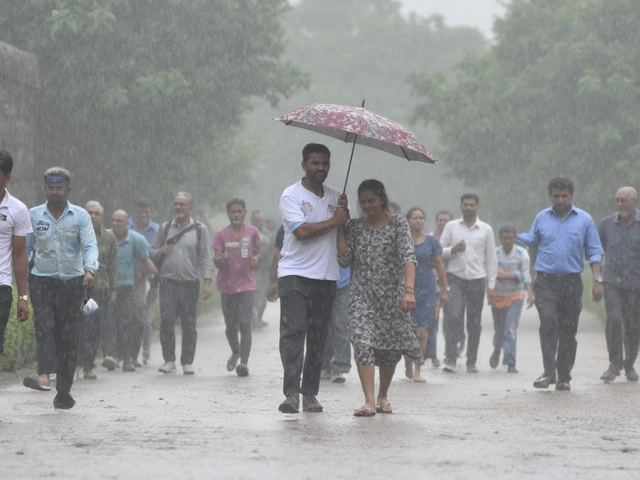
Humidity turns 33°C into a 45°C ordeal across Delhi-NCR
Step outside in Delhi and it feels closer to 45°C than the 32–33°C you see on your phone. That gap is the heat index at work, and it’s being driven by punishing humidity—hovering near 76–84 percent—and bursts of harsh sunshine. In its Aug 21 update, the India Meteorological Department (IMD) said this combination is creating dangerous conditions across the National Capital Region.
The broader monsoon has woken up again. Back-to-back low-pressure systems over the Bay of Bengal kicked off a rapid revival from Aug 14, sending heavy rain toward Konkan, Goa, and Madhya Maharashtra. Delhi, though, has been stuck in the steam bath. With the monsoon trough positioned north of the city, moist air sits over the region without consistent rain to cool it down.
Here’s why it feels so extreme. When humidity soars, sweat can’t evaporate efficiently, so your body struggles to shed heat. Add intense midday sun and the surface—roads, rooftops, even skin—absorbs more radiation. The result is a heat index that can jump well above the actual air temperature, pushing into the “danger” range for heat stress.
August in Delhi is naturally muggy. Typical daytime highs run from 29°C to 36°C with nights around 25–26°C. The city usually logs about 10 rainy days this month and 183–257 mm of rain. This year’s pattern fits the script in one frustrating way: humidity is high, but the steady rain that brings relief hasn’t settled in yet. Nights remain warm, so there’s little reset before the next day’s heat.
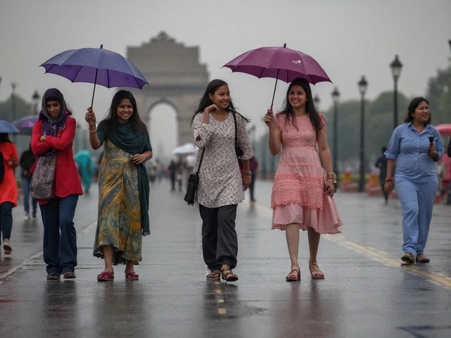
Rain relief likely this week—and how to cope until then
IMD forecasters expect light to moderate rain across most parts of the city within seven days as the monsoon belt shifts. Nearby regions in East and Central India are in line for isolated heavy showers between Aug 21 and 26. For Delhi, that likely means on-and-off spells—some brief, some longer—that can knock down the heat index for hours at a time. Humidity will remain high, so comfort will ebb and flow with the rain.
If you’re wondering how much better it gets after a shower, the immediate drop can feel dramatic: cloud cover cuts the solar load, winds pick up, and temperatures dip a couple of notches. But once the sun returns, the humid air can quickly make it feel hot again. Expect a stop-start feel to the week—sultry mornings, a chance of afternoon or evening thunderstorms, then a temporary break.
Until steadier rain arrives, think about heat risk the way you would a storm alert. The human body strains in these conditions. Dehydration, cramps, dizziness, nausea, and headaches are early red flags. Children, older adults, pregnant people, and those with heart or respiratory conditions are especially vulnerable. Outdoor workers—construction crews, delivery staff, traffic police—face the toughest hours, especially from late morning through mid-afternoon.
- Drink water often. Add ORS or a pinch of salt and sugar to one or two glasses a day if you’re sweating a lot.
- Avoid direct sun from 11 am to 4 pm when possible. Seek shade; carry an umbrella and sunglasses.
- Wear light, breathable clothes. Cotton and loose fits help sweat evaporate.
- Plan workouts early morning or after sunset. Slow your pace if you feel overheated.
- Use fans with cross-ventilation to move humid air; keep rooms shaded during the day.
- Never leave kids, older adults, or pets in parked cars. Cabin temperatures soar within minutes.
- Check on neighbors who live alone, especially in top-floor apartments.
- If you feel faint, stop, rest in a cool spot, sip fluids, and place a damp cloth on your neck and wrists. Seek medical help if symptoms persist.
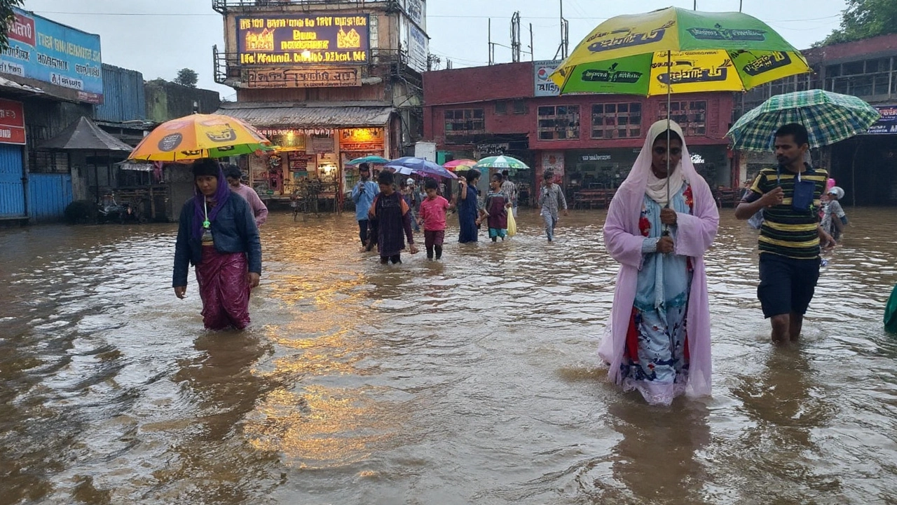
There’s also the city factor. Big concrete surfaces hold heat, so evenings can stay warm even after sunset. When showers do arrive, they may be sharp and brief. That can trigger quick waterlogging at known choke points and underpasses before drains catch up. If you’re driving and see pooled water, avoid it—turn around or take an alternate route.
What should you watch for on the sky front? Building towers of dark clouds on the western or southwestern horizon often hint at incoming thunderstorms. A burst of gusty wind can arrive before the first drops. Keep an eye out for lightning and take shelter if thunder is audible.
The IMD’s regional forecasting center in Delhi is tracking the setup closely, with updates aligned to changes in the monsoon trough and new low-pressure pulses over the Bay. The guidance is straightforward: hydrate, time your outdoor work, and be ready for a couple of rounds of showers that bring short-lived comfort. If you’ve been waiting for a proper August spell, the next week offers the best shot yet.
For searchers watching the daily forecast, the term to follow right now is Delhi weather. As the monsoon edges back into the region, day-to-day conditions will hinge on how quickly clouds thicken over the city and how long each rain spell lasts.